---
title: Using Data to Visualize Affordable Housing Preservation in Tennessee
description: See how THDA used the NHPD data to create an interactive StoryMap that visualizes affordable housing preservation trends and risks across Tennessee.
image: https://blog.haigroup.com/hubfs/NHPD-THDA-1.png
---
[Skip to content](https://blog.haigroup.com/building-a-statewide-preservation-strategy-in-tennessee#main-content)
[](https://www.haigroup.com/)
- SEARCH
- [Research](https://blog.haigroup.com/tag/research)
# Using Data to Visualize Affordable Housing Preservation in Tennessee

- August 20, 2026

[Ally Modugno | Marketing Specialist | HAI Group](https://blog.haigroup.com/author/ally-modugno)
[\< Back to Resource Center](https://blog.haigroup.com)
As affordable housing properties age and affordability restrictions begin to expire, understanding preservation challenges has become increasingly important for housing organizations across Tennessee.
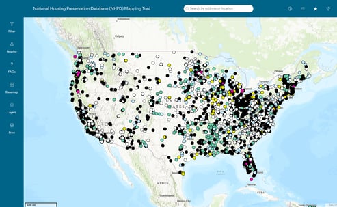
The [Tennessee Housing Development Agency (THDA)](https://thda.org/) recently used data from the [National Housing Preservation Database (NHPD)](https://preservationdatabase.org/) to develop the Tennessee Preservation StoryMap, an interactive resource that helps visualize affordable housing preservation trends and risks across the state.
## How THDA uses the NHPD
THDA is the state's housing finance agency, working to expand affordable housing opportunities and strengthen communities across Tennessee through financing programs, partnerships, and strategic initiatives that support renters, homeowners, and developers.
[](https://experience.arcgis.com/experience/8d2ba145d49545f3b9976443902b2a88/page/Page)
Nearly two years ago, the agency began exploring the NHPD, a nationwide database of federally assisted rental properties managed by the [Public and Affordable Housing Research Corporation (PAHRC)](http://www.pahrc.org), HAI Group’s research division, and the [National Low Income Housing Coalition](http://www.nlihc.org). The effort came amid growing concern about an approaching affordability “expiration cliff”—a period when a large number of Low-Income Housing Tax Credit (LIHTC) properties are expected to reach the end of their required affordability periods, potentially allowing owners to convert affordable units to market-rate housing. The agency wanted to better understand what this trend could mean for Tennessee’s affordable housing supply.
What began as an effort to better understand Tennessee's subsidized housing portfolio ultimately led to the [development of the Tennessee Preservation StoryMap](https://storymaps.arcgis.com/stories/1cb9b423a4f240aabb8d9609798e49ad), an interactive tool that visualizes affordable housing preservation data and encourages informed conversations among housing professionals and stakeholders.
## Understanding Tennessee's preservation challenge
Before using the NHPD, THDA found that preservation-related information was spread across multiple housing programs and data systems, making it difficult to develop a comprehensive picture of affordable housing preservation trends statewide. The NHPD consolidated information from multiple federally assisted housing programs into a single dataset, enabling statewide analysis and providing a clearer understanding of those trends.
## Turning data into a StoryMap
As the project evolved, the team sought a way to communicate the challenges and opportunities of affordable housing preservation to a broader audience, leading to the Tennessee Preservation StoryMap.
The StoryMap was developed by THDA's research and geographic information systems (GIS) team using the NHPD as a foundational data source. The project combines GIS, housing data, and narrative storytelling to make preservation information more accessible and easier to understand.[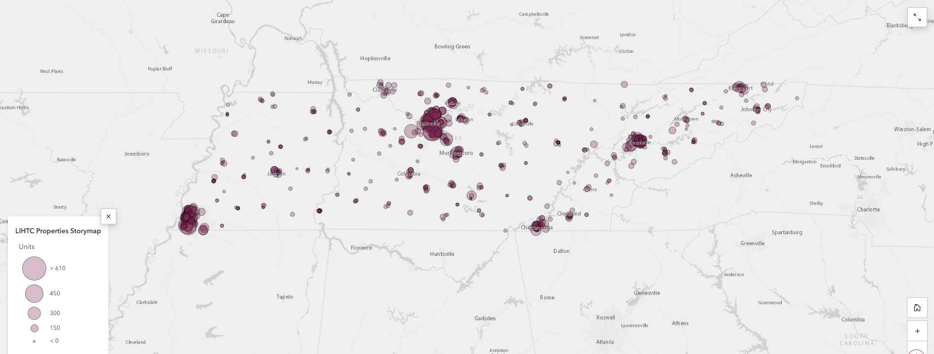](https://storymaps.arcgis.com/stories/1cb9b423a4f240aabb8d9609798e49ad)
## What the data revealed
The StoryMap helped THDA visualize Tennessee's potential LIHTC expiration cliff by examining development timelines, affordability restrictions, and projected preservation risks. Using NHPD data, the team estimated how waves of LIHTC development may translate into future waves of affordability expiration, helping identify where preservation pressures may emerge over time.
The analysis also highlighted important geographic differences across the state. While larger urban areas contain significant concentrations of affordable housing, many rural communities depend on only one or two subsidized developments. The loss of even a single property could have an outsized impact on housing availability in those communities.
## Building partnerships through data
Since its launch, the Tennessee Preservation StoryMap has provided a shared resource for local governments, housing organizations, researchers, and other stakeholders interested in affordable housing preservation.
The interactive format provides a common reference point for exploring preservation trends, identifying areas for additional analysis, and increasing awareness of affordable housing challenges across Tennessee.
## Advice for others using the NHPD
Organizations interested in using the NHPD can combine it with their own research and local knowledge to better understand affordable housing trends and communicate complex information through accessible tools such as interactive maps and data visualizations.
The Tennessee Preservation StoryMap demonstrates how housing organizations can transform publicly available data into a resource that helps stakeholders better understand affordable housing preservation trends and explore potential risks across their communities.
"A local preservation database like THDA's StoryMap can help states take a more proactive approach to preservation," says Kelly McElwain, director of research at PAHRC. "Organizations interested in developing a similar resource should [first request a data license](https://preservationdatabase.org/data-license-application/). The NHPD [user guide](https://preservationdatabase.org/documentation/user-guide/) also outlines additional considerations for building and using a local database."
## Explore THDA's Preservation StoryMap
Interested in exploring the Tennessee Preservation StoryMap? Learn more about affordable housing preservation trends, potential risks, and the data behind the interactive resource.
##### [View the Tennessee Preservation StoryMap](https://storymaps.arcgis.com/stories/1cb9b423a4f240aabb8d9609798e49ad)
###### [Explore the NHPD](https://preservationdatabase.org/) to access property-level data, preservation risk insights, and affordable housing trends nationwide.
[](https://blog.haigroup.com/hs/cta/wi/redirect?encryptedPayload=AVxigLK2HsGULrNmqqKXZ%2BM8SYld2ALIoWvhQXhuZPoTDWEQjQaGRIAK5%2BTt8NrY%2BL%2FEYKmK%2BqmiCnoqE6b9bvKVO06PsKu%2F0YGs8SKWYk%2FUaqTJSrqZK%2FyXLoW8kUqwyu418ffCjUNKq%2B1UxztI%2FMUDuzdJFIWjQ6nZGs6HL9dm67SfXJdis9WPi1EatrlnyiWLXWxJzEVK5UTk&webInteractiveContentId=209809949041&portalId=20790879)
###### Are you using the NHPD in your work? We want to hear from you. Share how your organization is using the database for preservation planning, policy, advocacy, research, housing navigation, or other efforts for a chance to be featured in an upcoming blog in this series.
[](https://blog.haigroup.com/hs/cta/wi/redirect?encryptedPayload=AVxigLKRzEk9ForxpV22U4ovmrlrj%2FGXguTefggLvle9fHqCNBHDnF9K1UI9SakAxFIdi1jmodPKY%2BP9d0cee0YqchiD0g1I6MvP7bCFaYpHuaEsvKr2zbCgwupp1j9LiWU3eMflrwskyVA2uujrMGm4MtkZSBtXe6B82UJEOa7MfPua9EtOqYbDawZn1%2F1JZxRmr61xPDbRg7dm%2B3Tskd7X8xDUOu%2Bwoyga5d0L9r5%2B&webInteractiveContentId=213402939162&portalId=20790879)
The information presented is for general reference only. HAI Group makes no representation or warranty about the accuracy or applicability of this information for any particular use or circumstance. Your use of this information is at your own discretion and risk. HAI Group and any author or contributor identified herein assume no responsibility for your use of this information. You should consult with your legal, professional or subject matter advisor before implementing any new strategy or policy.
HAI Group® is the registered trademark of Housing Authority Risk Retention Group, Inc. and its related companies. For a complete list of HAI Group companies, visit www.haigroup.com. Products or services may not be available in all jurisdictions. Certain property and casualty coverage may be provided by a risk retention group or a surplus lines insurer or by a third party. Risk retention groups and surplus lines insurers do not participate in state guaranty funds and their insureds are not protected by such funds.
Don't Miss This
## Related Content
[](https://blog.haigroup.com/preserving-affordable-housing-insights-and-resources-from-pahrc-and-nlihcs-virtual-event)
- August 20, 2026
### [Preserving Affordable Housing: Insights and Resources from PAHRC and NLIHC's Virtual Event](https://blog.haigroup.com/preserving-affordable-housing-insights-and-resources-from-pahrc-and-nlihcs-virtual-event)
December 19, 2024
The Public and Affordable Housing Research Corporation (PAHRC) and the National Low Income Housing Coalition (NLIHC)...
[Read more](https://blog.haigroup.com/preserving-affordable-housing-insights-and-resources-from-pahrc-and-nlihcs-virtual-event)
[](https://blog.haigroup.com/how-the-housing-collective-uses-the-nhpd-to-protect-affordable-housing)
- August 20, 2026
### [How The Housing Collective Uses The NHPD to Protect Affordable Housing](https://blog.haigroup.com/how-the-housing-collective-uses-the-nhpd-to-protect-affordable-housing)
March 26, 2026
Across the country, housing organizations are working to preserve existing affordable housing while expanding supply....
[Read more](https://blog.haigroup.com/how-the-housing-collective-uses-the-nhpd-to-protect-affordable-housing)
[](https://blog.haigroup.com/using-data-to-protect-affordable-housing-in-rhode-island)
- August 20, 2026
### [Using Data to Protect Affordable Housing in Rhode Island](https://blog.haigroup.com/using-data-to-protect-affordable-housing-in-rhode-island)
June 15, 2026
The National Housing Preservation Database (NHPD) is a nationwide database of federally assisted rental housing...
[Read more](https://blog.haigroup.com/using-data-to-protect-affordable-housing-in-rhode-island)

- [Online Privacy Policy](https://www.haigroup.com/privacy-policy/)
- [California Privacy Rights](https://www.haigroup.com/wp-content/uploads/2024/11/HAI-Group-CA-Privacy-Rights-Notice-1.pdf)
- [Terms of Use](https://www.haigroup.com/terms-of-use/)
```json
{
"@context" : "https://schema.org",
"@type" : "BlogPosting",
"author" : {
"@type" : "Person",
"name" : "Ally Modugno | Marketing Specialist | HAI Group",
"url" : "https://blog.haigroup.com/author/ally-modugno"
},
"dateModified" : "2026-08-20T19:51:12.657Z",
"datePublished" : "2026-08-20T19:51:12.000Z",
"headline" : "Using Data to Visualize Affordable Housing Preservation in Tennessee",
"image" : [ "https://blog.haigroup.com/hubfs/NHPD-THDA-1.png" ],
"mainEntityOfPage" : {
"@id" : "https://blog.haigroup.com/building-a-statewide-preservation-strategy-in-tennessee",
"@type" : "WebPage"
},
"publisher" : {
"@type" : "Organization",
"logo" : {
"@type" : "ImageObject",
"url" : "https://blog.haigroup.com/hubfs/HAIGroup%20PMS2186C%20400X100-300dpi-1.png"
},
"name" : "HARRG"
}
}
```